Pathways into the Past: Muir of Ord and Maryburgh
The first two sections of the routeway running from Tarradale to Tain were examined by the communities of Muir of Ord and Maryburgh. We were looking for remains of the routeway or sites that might have been associated with the routeway through the periods of its use. From the research done so far it looks possible that the routeway may be medieval or earlier in origin but more work needs to take place before this can be confirmed.
Sites investigated included:
Bishop Kinkell Chambered Cairn, Whiteleys Chambered Cairn, Conon Henge and Muir of Ord Henge (Castle Hill). These earlier prehistoric sites indicate the landscape and region was important in earlier periods, perhaps leading to the initial formation of routeways through this area. (MHG8989) (MHG9029) (MHG9059) (MHG9108)
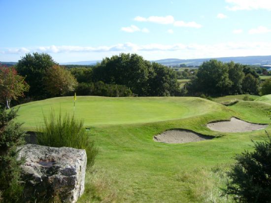
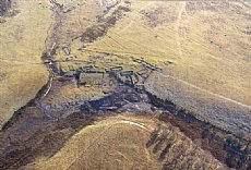
Castle Hill Henge, Muir of Ord
Davids Fort. This moated site, a seat of power for the region, is thought to be medieval in date and may have been contemporary with the routeway. (MHG8986)
Logiebride Cemetery. This site was plane table surveyed (to be completed later in 2011) to try and provide a plan drawing of the site and to help determine how it would have been related to the routeway.(MHG39644)
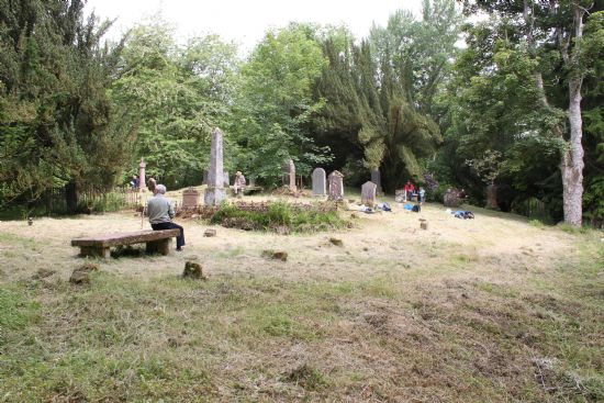
Logiebride Cemetery Survey
Dunglass Island Crossing Point - an interesting puzzle to try and decide where the routeway would have crossed the River Conan, would a bridge have been necessary or would a fording point have sufficed?
Spittal Wood Double Embanked Feature. Good remains of the routeway still exist in Spittal Wood in the form of a double embanked feature.
Balvaird Wood. A similarly well preserved section of routeway, this is even marked on the modern OS map.
Tallysow Placename. A placename associated with a structure used for accommodating people or travellers over night, sometimes military (see Watson, W.J Placenames of Ross and Cromarty).
The group also looked at later medieval sites such as Kinkell Castle (a 16th century towerhouse) as evidence that the area continued to be important and would have needed structured routeways running through it. (MHG9028)
In addition to the archaeological sites in the region the group also discussed life for people using the routeways in medieval times whether for trading, pilgrimage or visiting other settlements. Subsequent use of the routeways for droving and traveling across Easter Ross was also covered briefly as part of the display.
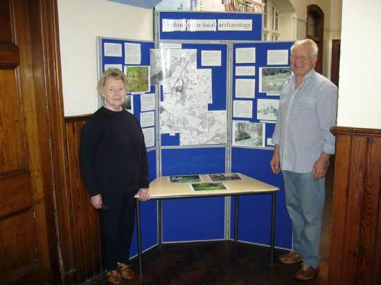
Finished display put together by Gordon and Margaret.
Further information can be found:
Latest News...
15/07/2026 - ARCH Digitising Highland Maps and Plans project - volunteers wanted!
Welcome Claire Boardman, our newly appointed project officer for the Digitish Highland Map... More >>
10/06/2026 - Wanted: project officer for ARCH Digitising Highland Maps and Plans project
ARCH is looking to recruit a project officer for The Digitisng Highland Maps and Plans pro... More >>
27/01/2026 - Highland Heritage Day 2026 - Booking form and timetable available
This year's Highland Heritage Day will take place on Saturday 14th March at Dingwall A... More >>
Site of the Month
 10/04/2021 - Easter Raitts township
Easter Raitts township Photo: Highland HER Although the Highlands is dotted with de... More >>
Find of the Month
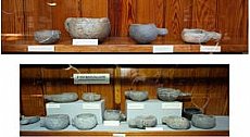 25/07/2022 - Steatite Vessels
These stone vessels, many with handles, were found at a variety of sites in Sutherland and... More >>